
August is almost off from work for me, not much work load so a good time to go away from the hot weather and enjoy some good time. The plan was to visit this place called Naran, a beautiful valley almost on the edge of the Northwest Frontier Province. Geologically, the area falls under the Karakoram-Himalaya crystalline thrust zone. Two years back the area was hit by a disastrous earthquake in the country’s history, the origin of the earthquake was somewhere near this area and it was so severe that shocks were felt even as far as 700km away.
I have been to this place three rimes before but first time since the earthquake. As you enter the worst hit area, the roads there are still under construction, however the traffic keeps moving alongside. The pics you see here I took with my brother’s cell-phone camera, I know I should have had a good one for this trip but I am saving money to invest in one digital camera I might be able to buy soon.
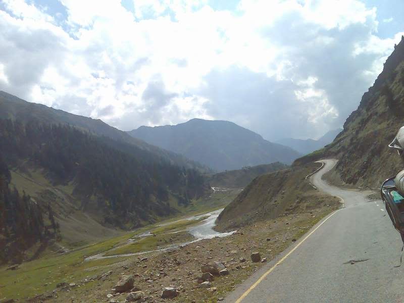
Starting with the pics…This first pic is half way through the journey from home. The monstrous mountain range starts right as you leave the Balakot area. The 40km part of this road from Balakot to Naran is under construction and at a few points it is quite a task for a car. This is a bit better part of it:
These pics are not copyrighted, you are welcome to download them. However, I would appreciate if you posted a comment about any pic you downloaded.
I have been to this place three rimes before but first time since the earthquake. As you enter the worst hit area, the roads there are still under construction, however the traffic keeps moving alongside. The pics you see here I took with my brother’s cell-phone camera, I know I should have had a good one for this trip but I am saving money to invest in one digital camera I might be able to buy soon.
Starting with the pics…This first pic is half way through the journey from home. The monstrous mountain range starts right as you leave the Balakot area. The 40km part of this road from Balakot to Naran is under construction and at a few points it is quite a task for a car. This is a bit better part of it:
These pics are not copyrighted, you are welcome to download them. However, I would appreciate if you posted a comment about any pic you downloaded.
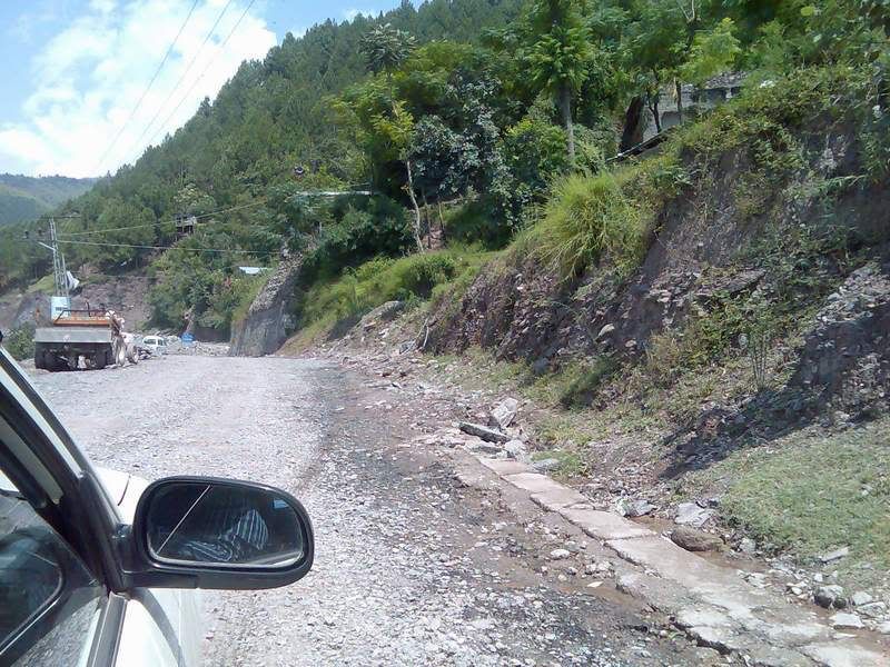
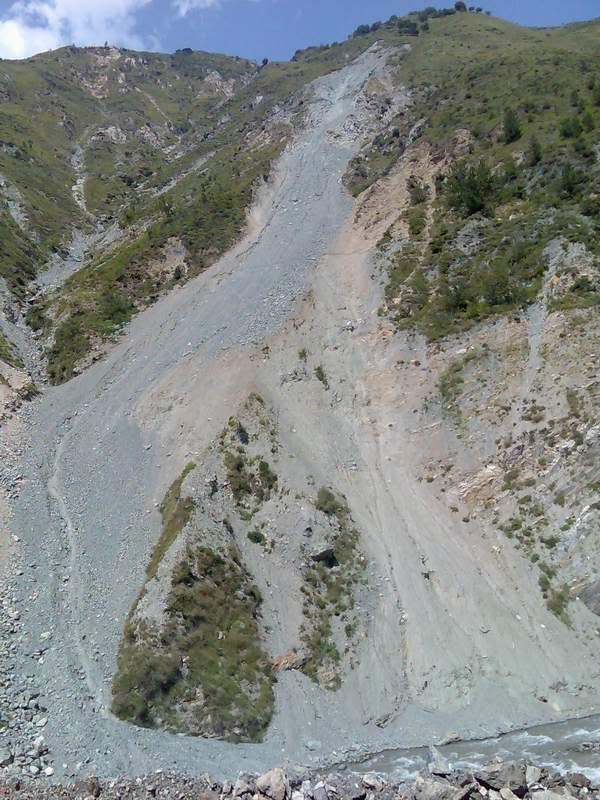
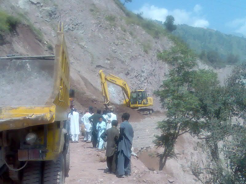
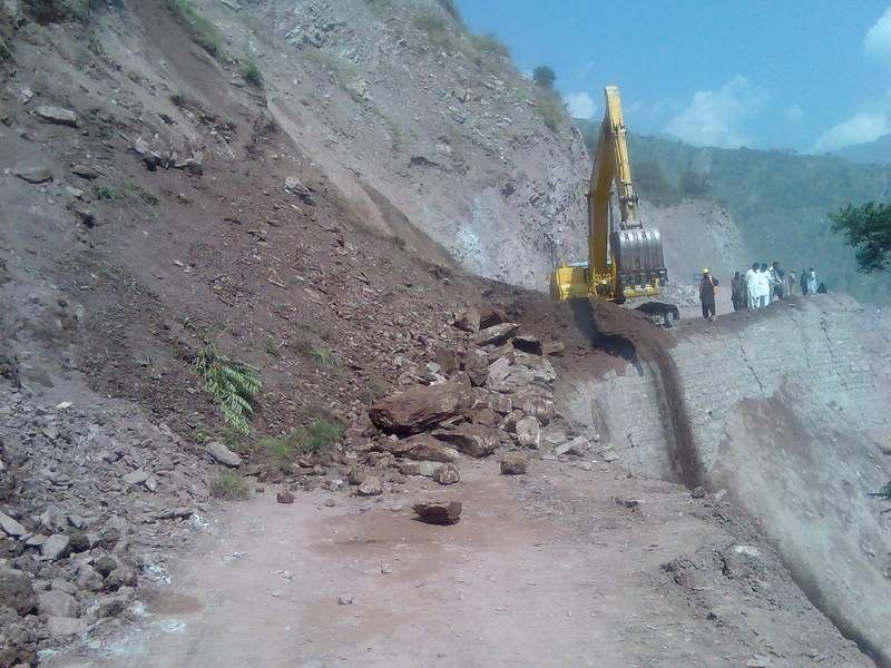
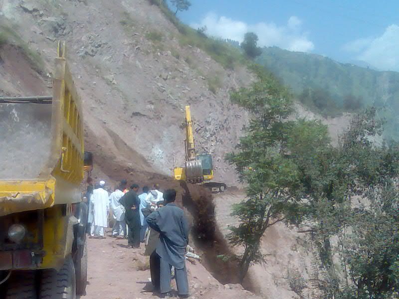
The current look of this mountain is on account of the land sliding since the earthquake:
We had left home at 5a.m. and had our breakfast and lunch on our way to Naran. This pic was taken on the hotel where we took our lunch:

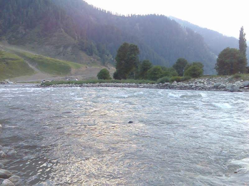
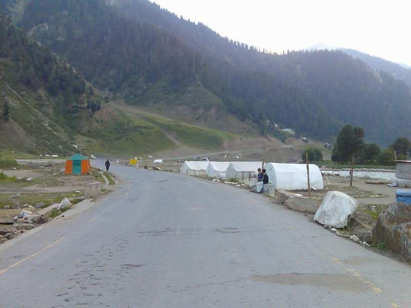
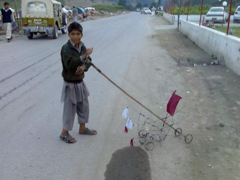
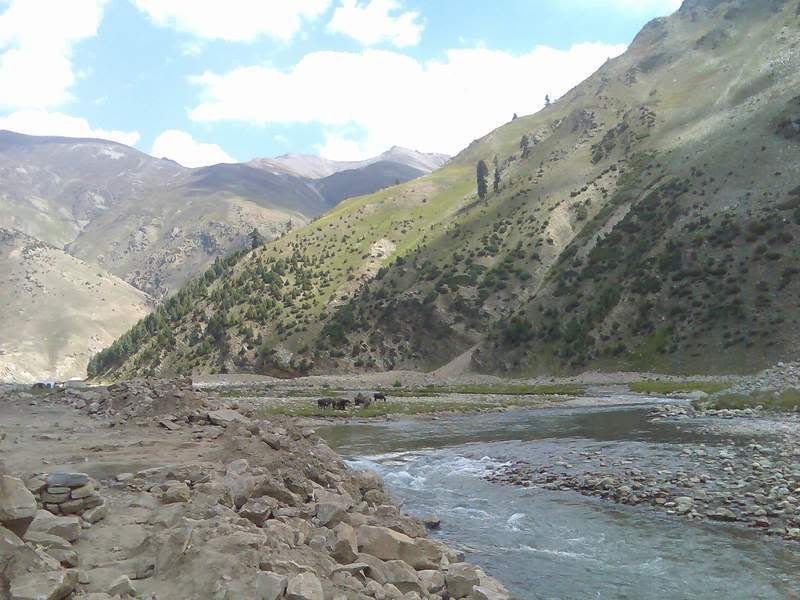
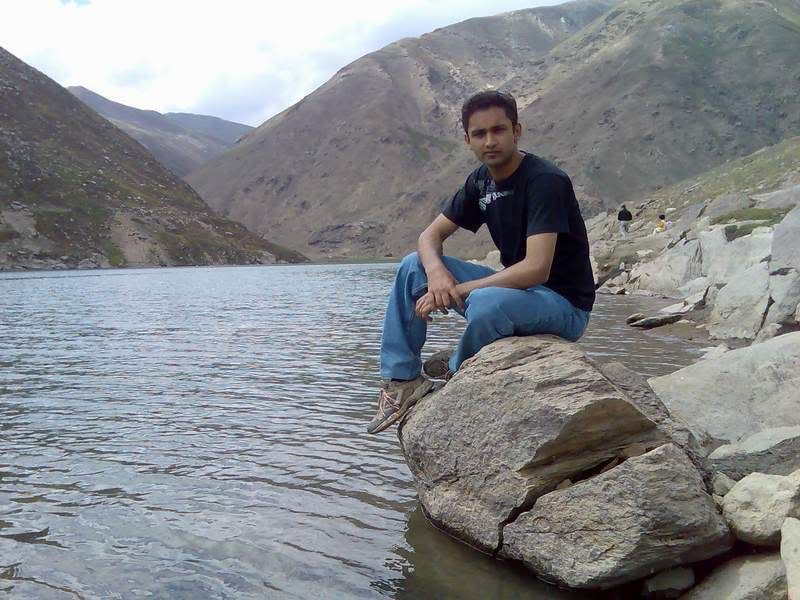
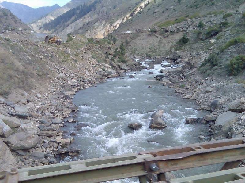
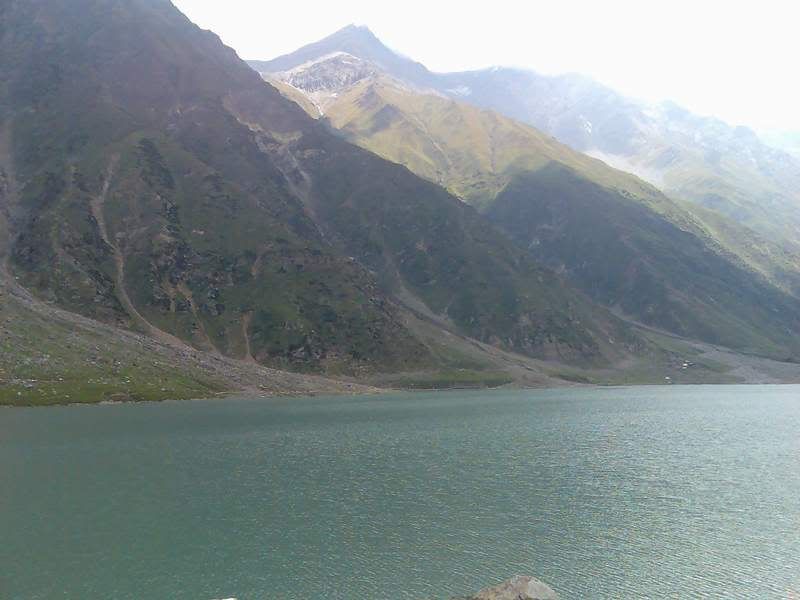
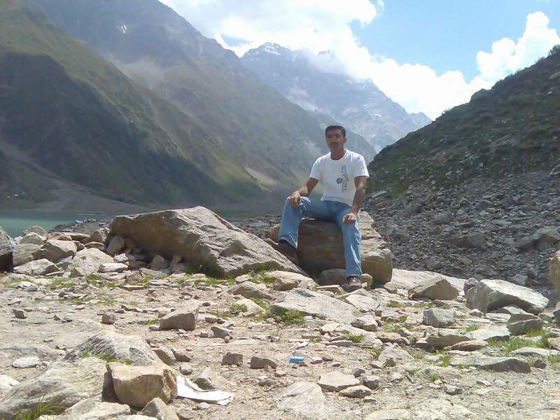
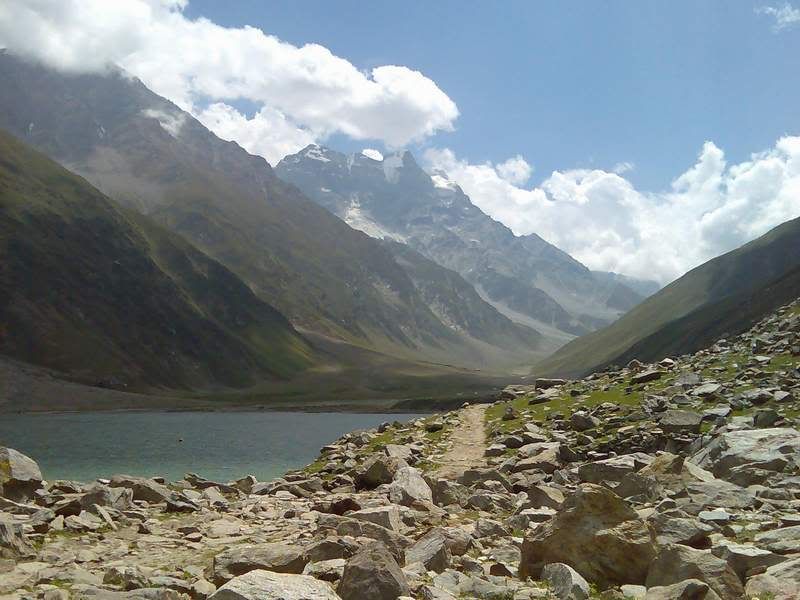
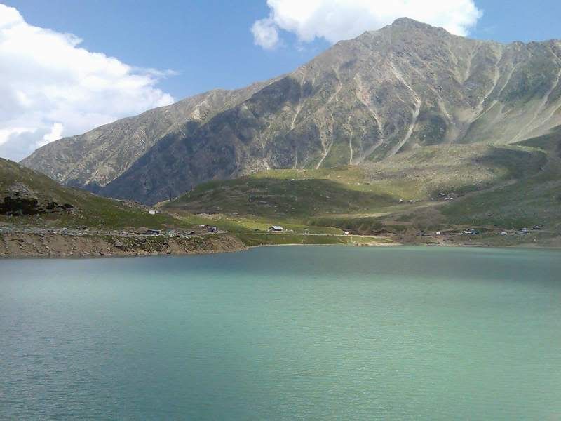
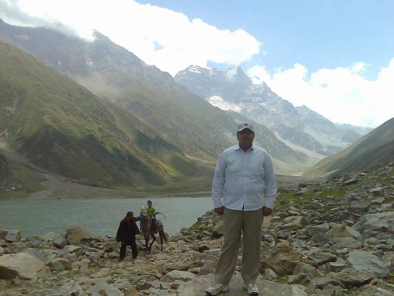
We reached Naran in the evening at about 6p.m and found ourselves lodging. Passed the evening by the river side and of course some pics:

A local kid was enjoying this hand made truck like thing:
Many people of the area do their living through cattle:

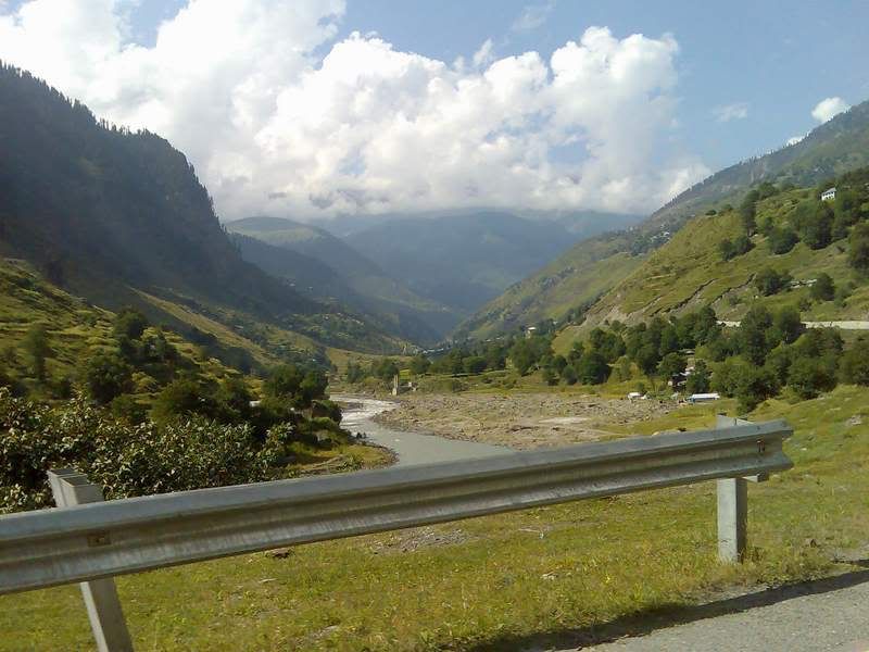
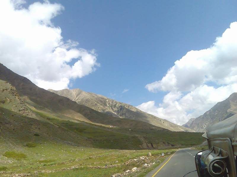
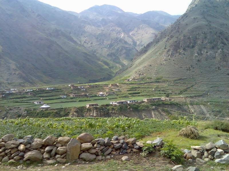
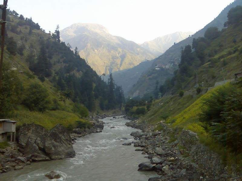
On the following day we were to go to a place at a height of about 13000feet. From Naran to Jalkath 40km road is well built and after that there is jeep track that takes you to a very beautiful lake called Luluputser Lake. As you move from Naran to Jalkath you come across what should be called the greatest landscape on earth. I took some pics while sitting packed in the rear seat but they are still worth looking:
One day I would love to ride through these roads on a Harley Sportster, or a harley Fatboy ir even some dirt bike, perhaps....since Harleys are too costly :-)
Simply amazing, beauty..How much do I miss a cruising Harley...
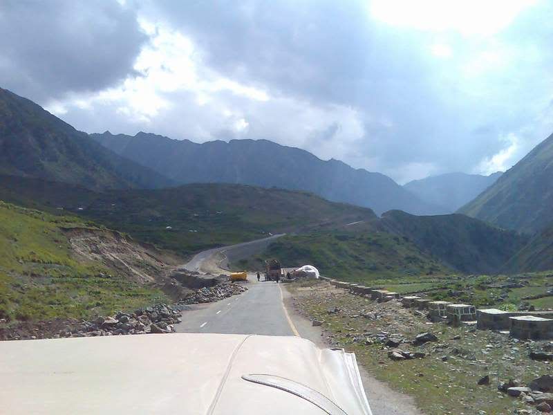
We reached Jalkhat in about 45 minutes and took some pics here:
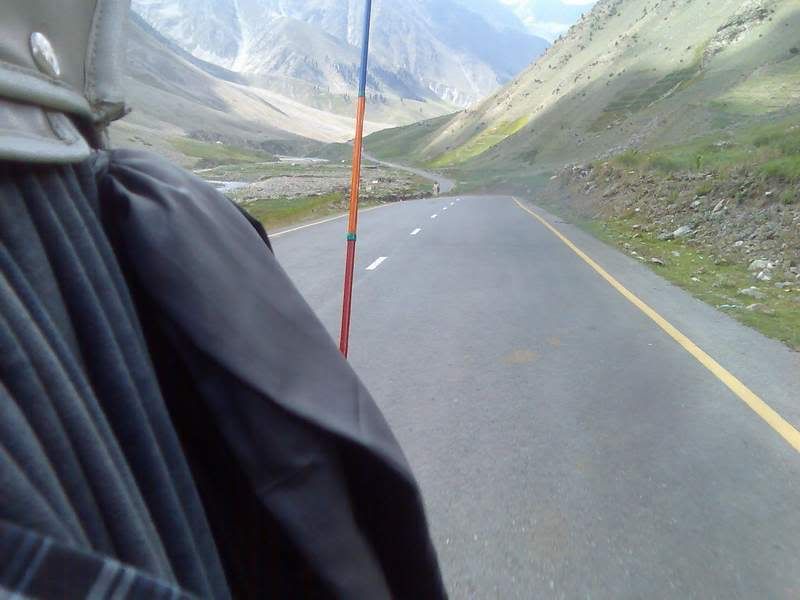
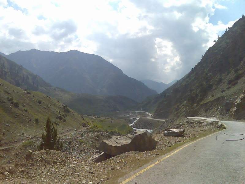
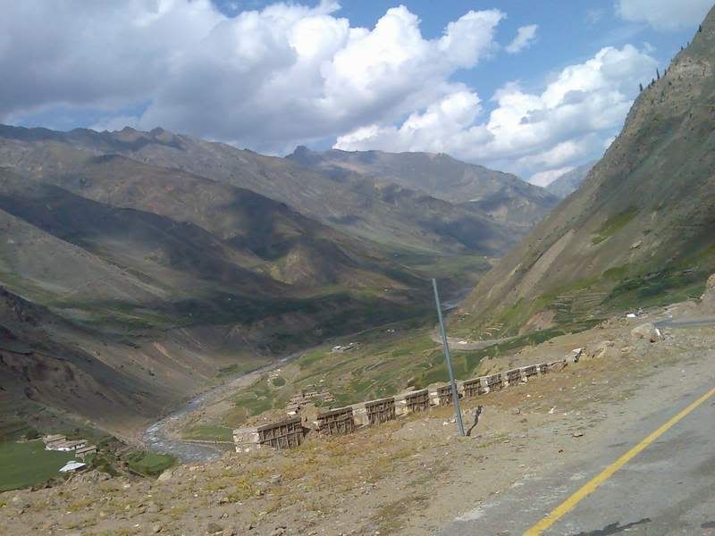
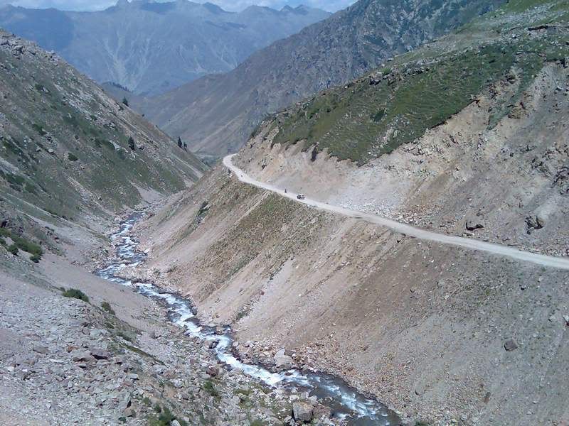
From this place ahead the road is under construction. The road should complete in about two years time, after which this would be the new route to go to China by road. At present you can go to China by Karakoram Highway but that area is n longer safe for journey.
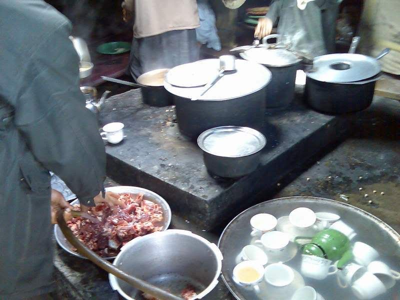
We took lunch at Jalkhat as there are no hotels for several miles ahead. A look of the hotel’s kitchen here:
We took lunch at Jalkhat as there are no hotels for several miles ahead. A look of the hotel’s kitchen here:
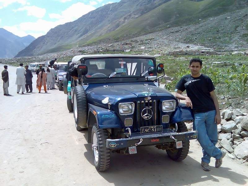
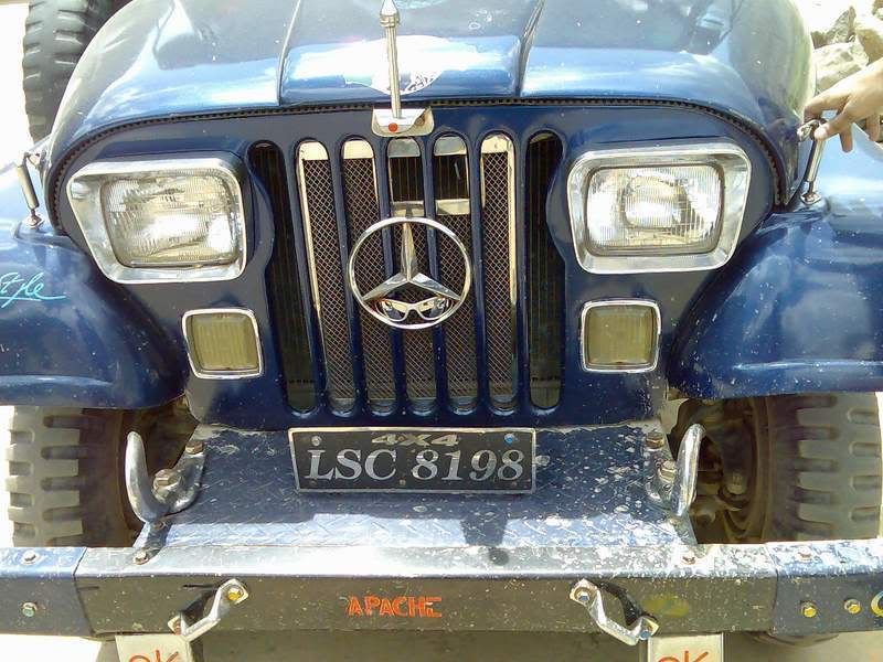
The jeep we hired for this journey:
Kind of interesting:
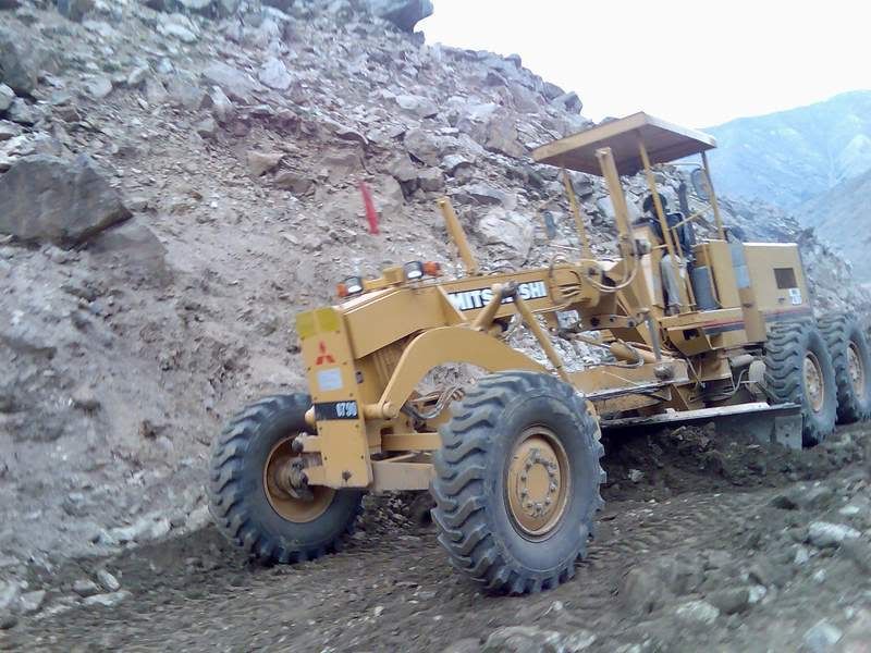
Work under progress on the road:
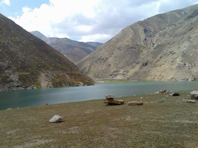
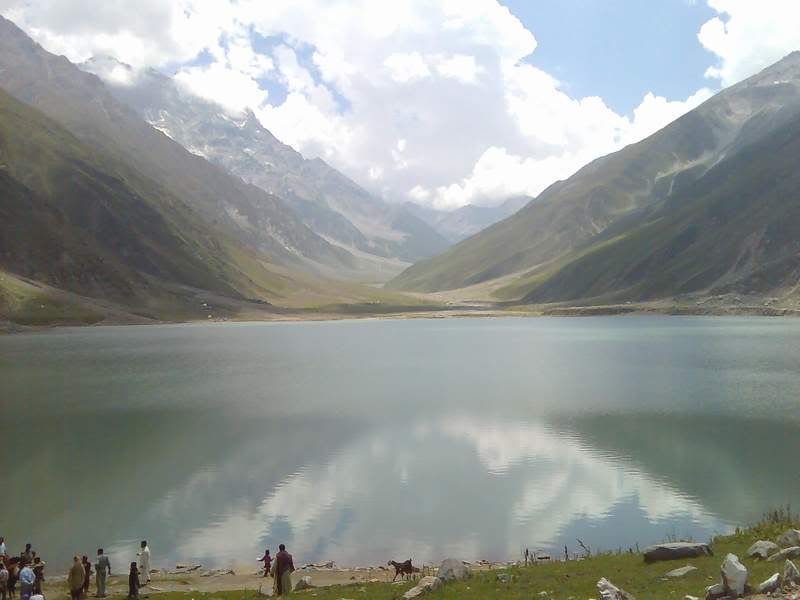
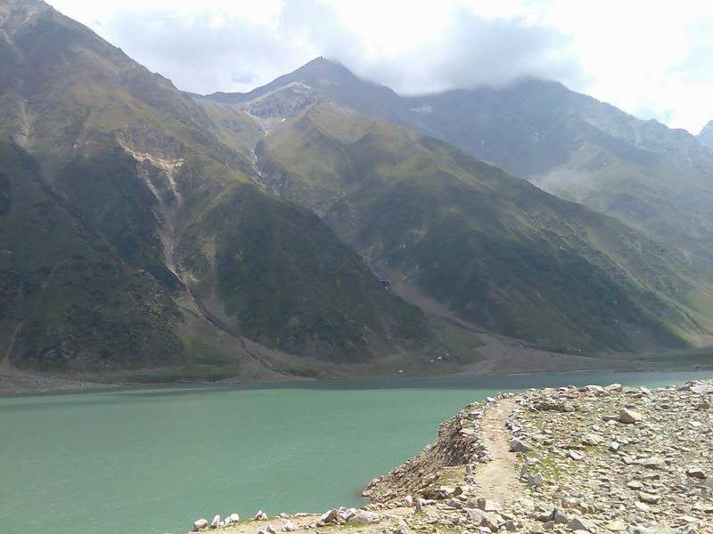
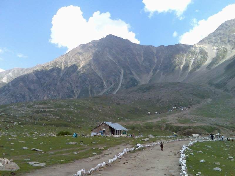
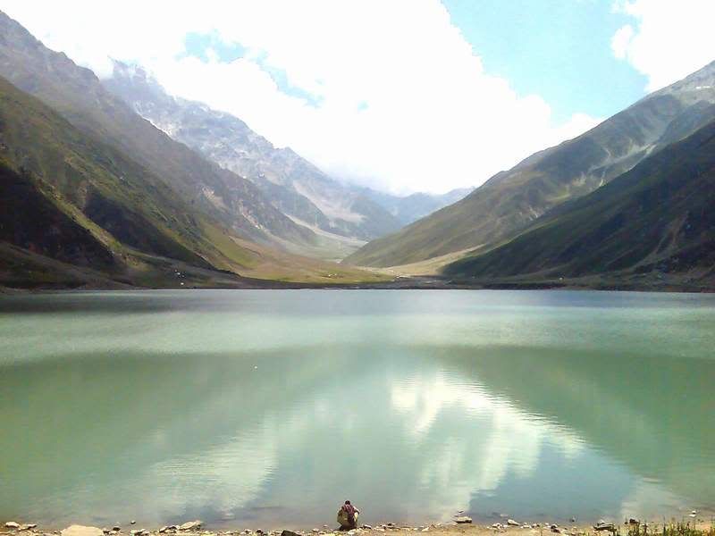
Because the road is quite bad, it takes about 50 minutes to reach Luluputser lake from Jalkhat. The place really impressive, a lake at a height of 13000feet.
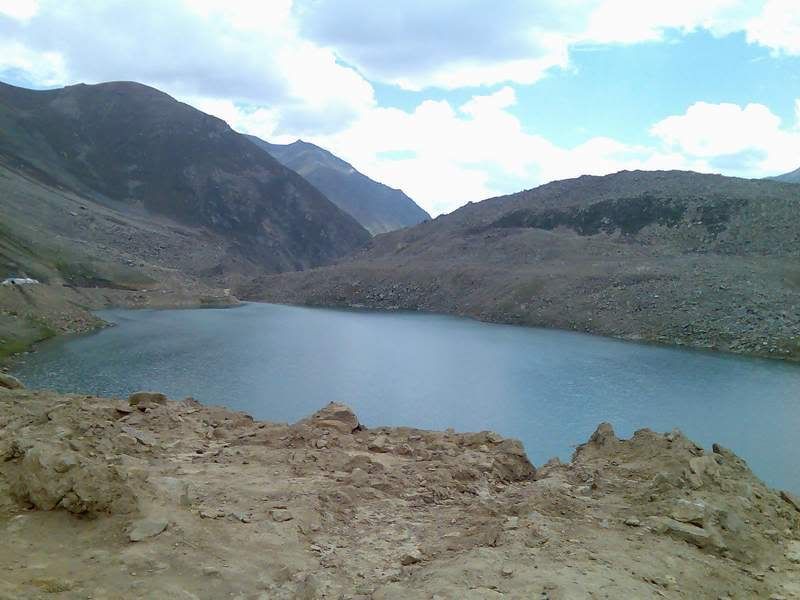
Clouds made the lake look even better:
We discovered a cave here but the entrance had been closed for unknown reason:

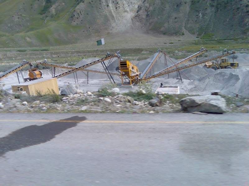
For building the road, the area has its stone crushing plant:

Green fields, and green mountains give such a pleasant look:
Some more pics I took on our way back to Naran:

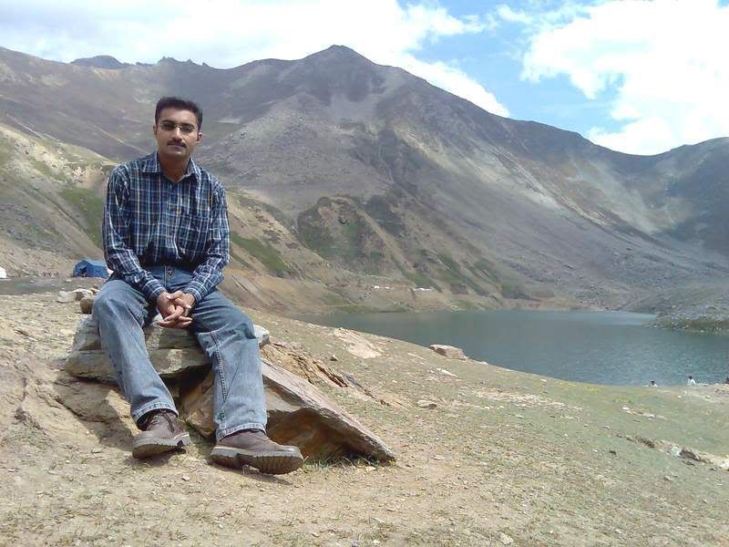
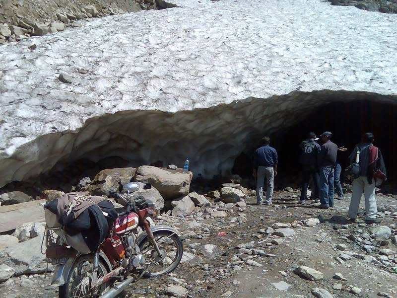
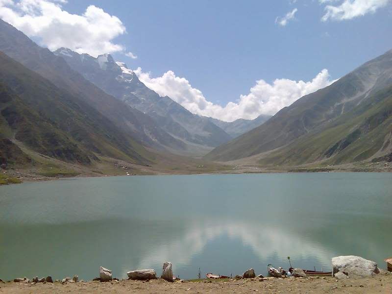
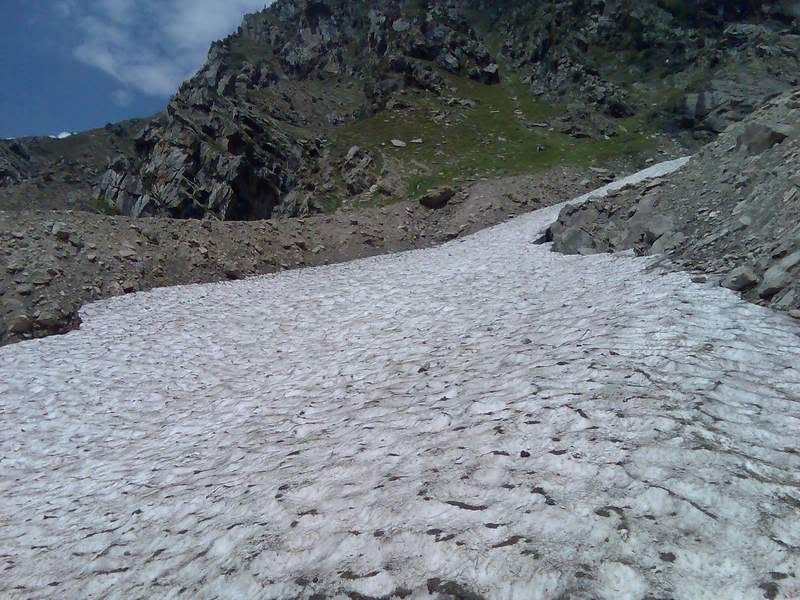
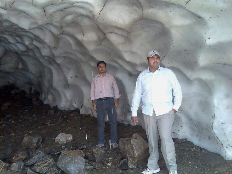
Next day we were to visit a lake which can undoubtedly be called as one of the most beautiful lakes on earth. It is called lake Saif-ul-Malook. The road from Naran to this lake is a pure jeep track. However, some adventurers were going on their bikes. Here you see a 100cc bike parked by a glacier for some pics. I have been to this lake two times before and this glacier has always been here:
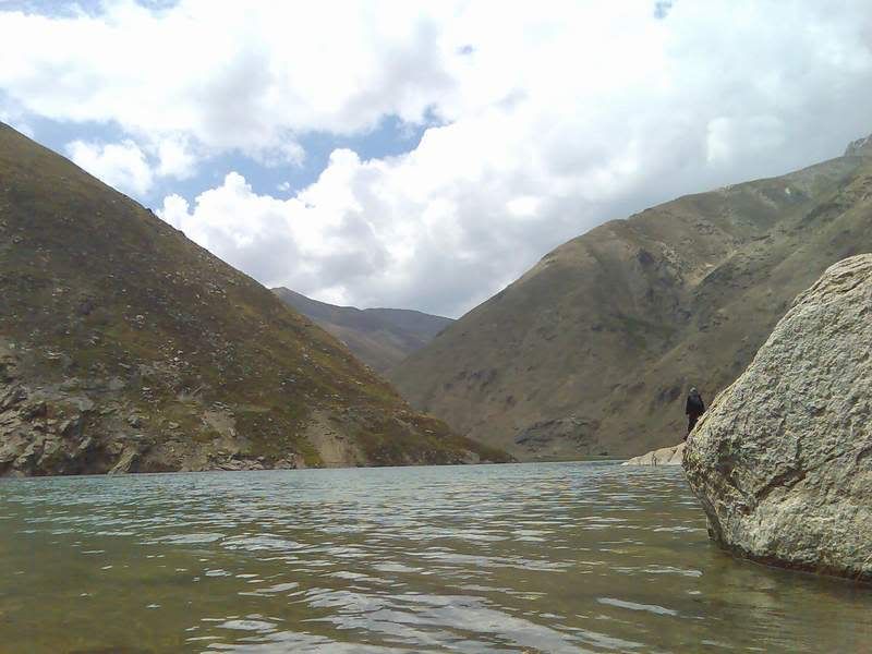
Lake Saif-ul-Malook:
This is almost the end of the season here. Soon the snows will cover everything and the whole area would be blocked, local people would move to Balakot and surrounding areas till the snows start to melt. The lake gives the greatest look at the start of the season when the hills in the background are all covered with snow and the lake’s water is pure blue. It still looks great though:
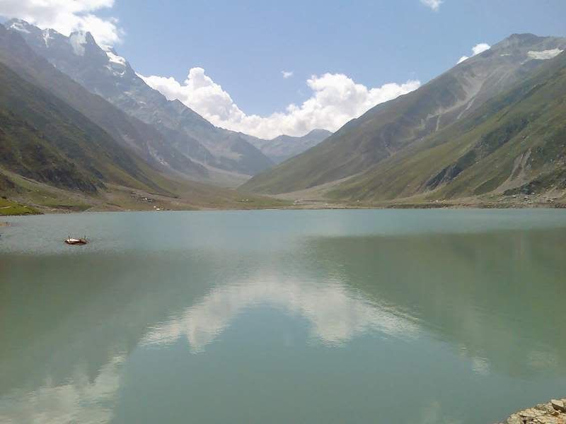
Notice the reflection in water:
Notice the reflection in water:
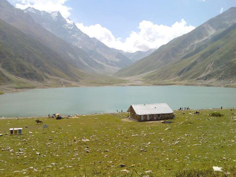
There’s a hut of the forestry department here:
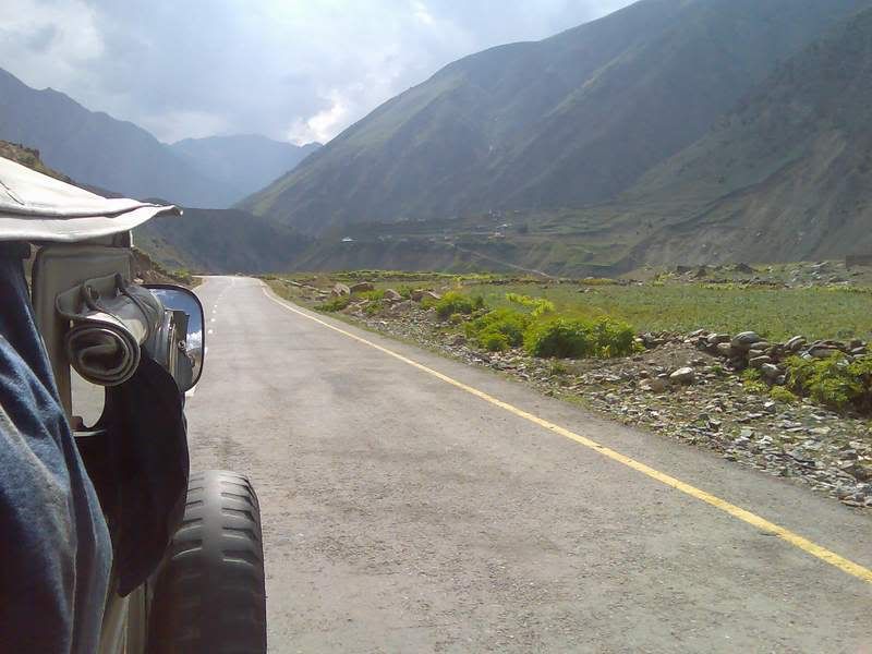
The road from Naran to this lake:
The weather at once gets cold as the clouds cover the sky:
I would love to wander through these mountains, venture to climb the Malka Parbat, but you never have enough time..

The snow covered mountain in the background is called Malka Purbat (the Queen Mountain) As per the information I got from our jeep driver, no one has ever climbed it. Few years back to Pakistani climber attempted for it, one died and the other was severely injured. The dead one’s corpse could be recovered after 22 days. That’s the mountain covered with clouds:
Some more pics:
We stopped at the glacier on our way back to Naran:
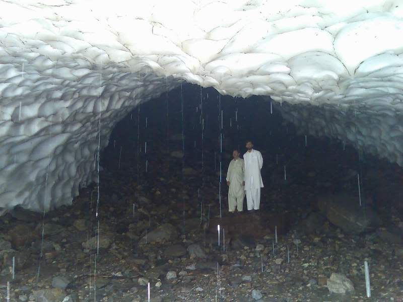
Water drops keep on falling and the inside is pretty cold to stand for too long:
We moved for the return journey early in the morning on the following day. Since the earthquake, land sliding on these mountains is a routine. We took our breakfast at Mahandri. There was a school on the other side of the river. Interestingly, we couldn’t locate any teacher in the school during our half an hour stay here. The assembly was conducted by the students on their own.
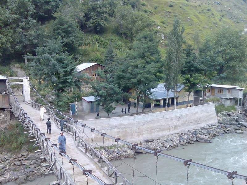
The assembly time:
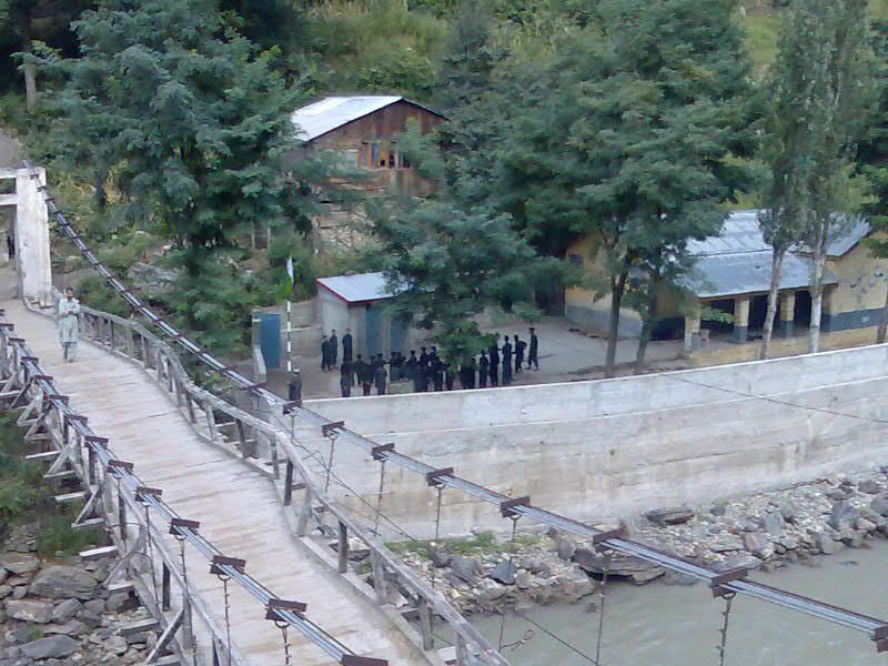
The river, quite a place for a school though:
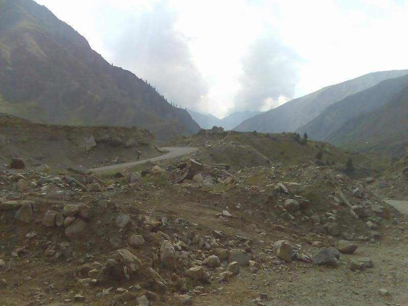
As feared, there was land sliding ahead and we were blocked for about an hour and a half:
It was one of the most exciting of my rides. I have a dream of one day visiting this place on my bike. But not yet and not on my current bikes.
2 comments:
Very nice pictures!
^Thanks for the appreciation.
Post a Comment